


Points of Interest:
- A wild and remote landscape of steep bluffs and deep valleys.
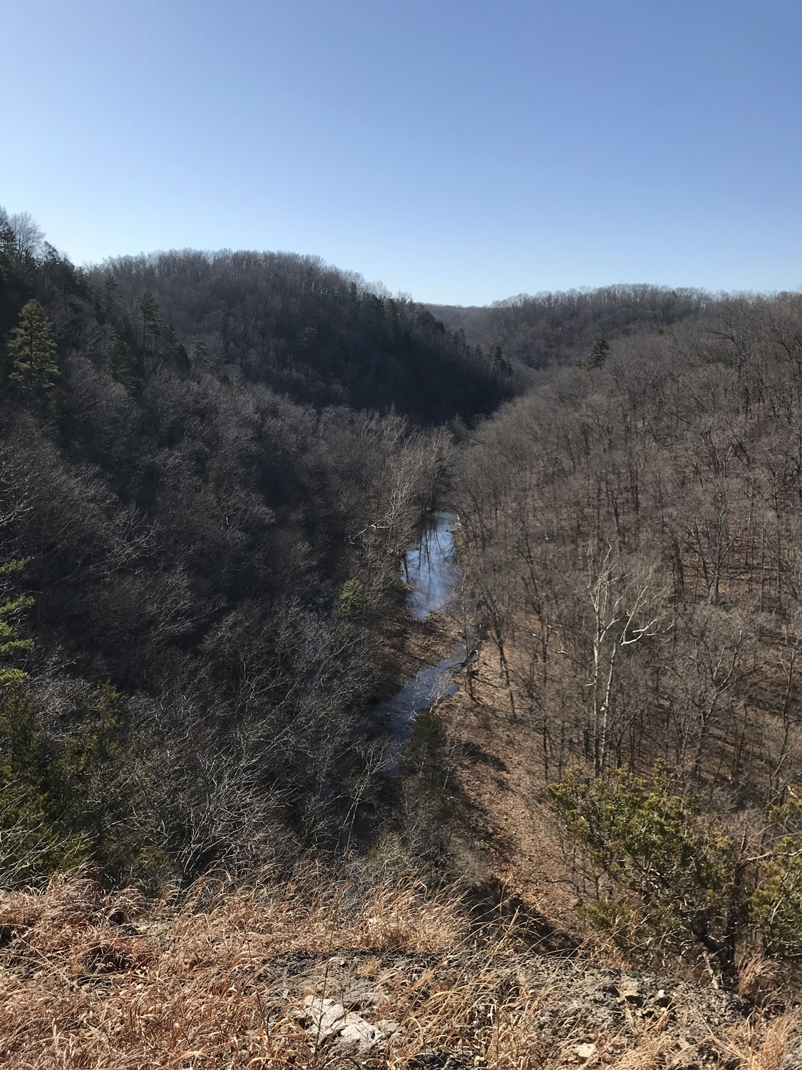
- Leatherwood Creek is a significant spring-fed headwater tributary of the Jacks Fork.
- The multitude of natural community types here supports over 500 native plant species.
Natural Features Description:
The upper reaches of Leatherwood Creek cut through the Roubidoux geologic formation which consists of sandstone. Moving downstream the creek is very sinuous with up to 400 feet of relief from the valley floor to the ridgetops and is bracketed by steep dolomite bluffs of the Gasconade formation. A wide variety of cliff, forest, woodland and fen natural communities occur in the valley. These habitats support a wide variety of native plants and animals characteristic of the Ozarks. The creek itself supports darters and other fish species indicative of good water quality. Some of the plant species found here are considered “glacial relicts” and are more common in the great lake states to the north. These species find steep and protected north facing slopes where they can persist in the otherwise drier Ozark woodlands that surround them.
Leatherwood Creek Natural Area is owned by the L-A-D Foundation’s Pioneer Forest (https://ladfoundation.org, 314-621-0230), which is dedicated to sustainable forest management and protection of exemplary natural and cultural areas in Missouri. Leo Drey, one of Missouri’s outstanding conservationists, established Pioneer Forest in 1951 and began the Foundation in 1962. Today Pioneer Forest practices sustainable forestry on more than 140,000 acres in the Missouri Ozarks. Missouri’s Natural Areas Program owes much to the pioneering work of Leo Drey and the L-A-D Foundation.
There are no developed facilities at this site. The site is open to the public for foot traffic and hunting and fishing. Access is remote and difficult and requires advanced outdoors skills. The easiest way to access the site is to float the Jacks Fork River and get out at the confluence of the Jacks Fork and Leatherwood Creek. Another option would be to access the site overland via county road. A high clearance, 4wd vehicle is recommended. The best way to do that is as follows: head south from Summersville on Highway 17. At the intersection of Highway 17 and WW head east on WW. In 2 miles the paved road WW ends and the gravel county road WW-D begins. Follow this county gravel road east for about 2.7 miles. At this point, park your vehicle off the gravel road and head down a two-track old lane on foot. This old lane descends into Rough Hollow which is a part of the natural area. From here you will need to utilize maps and compass and GPS (recommended) to access Leatherwood Creek itself.
United States